All school activities (except for the school dinner) will take place at the Niels Bohr Institute (NBI), located on Blegdamsvej 17, Copenhagen 2100.
Open this Google map for the positions of nearby public transport stops and walking directions.
(For a full city map with nearby sights and restaurants, open instead this Google map.)
For public transport times and lines, you can use Google Maps. Alternatively, you can use the Danish route planning service, Rejseplanen.
Arriving at NBI by Metro
There are three Metro stations close to NBI. Below are the approximate distance and walking times from each of them to NBI:
- Trianglen (400 m, 4 min): This is the closest Metro station
- Østerport (1 km, 17 min): This is also a bus hub and train station
- Norreport (2 km, 26 min): This is also a bus hub and train station
See this Google map for Metro directions. You can use Google maps to find Metro times.
Arriving at NBI by bus
If you arrive by bus, bus 1A stops right in front of NBI, at Irmingersgade (Blegdamsvej) stop.
See this Google map for bus directions. You can use Google maps to find bus times.
Arriving at NBI by foot
You can walk to NBI from anywhere inside the district where NBI is located, Østerbro, or from the neighboring districts of Vesterbro, Nørrebro, and Frederiksberg, and from the city center.
See this Google map for walking directions.
Arriving at NBI by bike
You can bike to NBI from anywhere in the city. Beware of heavy bike traffic. We recommend to try this only if you have experience with heavy urban bike traffic.
See here for a list of bike rental companies.
See this Google map for biking directions.
Inside NBI
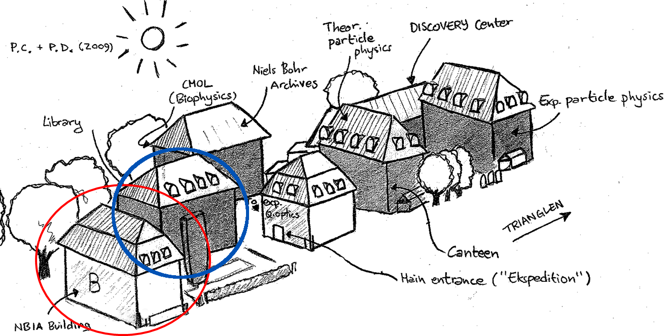
Once you arrive at NBI, enter via the main door of building B (circled in red below). Once inside, stay on the ground floor and walk right along the hallway until you reach Auditorium A (circled in blue below). There will be signs with directions to guide you.


